The actual crash site location is UTM GC 48Q WG 59492 44009 based on the location excavated.
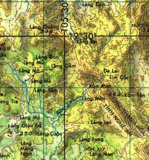
The location reported when Jack's plane went down was UTM GC 48Q WG 524 542. The longitude and latitude reported when Jack's plane went down was longitude 192900N, lattitude 1053000E. You will see on this map the location 19 degrees 30 minutes north and 105 degrees 30 minutes east.
Find the intersection of longitude 19' 30" and 105' 30". Below that location is the intersection of UTM grids 5 and 4,near the border of Thanh Hoa province and Nghe An province. The crash site is just inside the Nghe An province in that general vacinity.
![]()