Philips Family

Home | Early VA Map | Early Philips VA Land Grants | Tarboro NC Philips Map | Edgecombe NC Census | Battle of Kings Mountain | Nashville History | Tennessee History | Early Tennessee | Philips of Early VA | (2) John Philips, Sr. | (3) John Philips, Jr. | (3) Joseph Philips, Sr | (3) Arthur Philips | (3) Hartwell Philips Family | (4) Joseph Philips, Jr. | Milberry Horn Philips | Cour de Lion Thoroughbred | (4) Exum Philips | (4) Matthew Philips | (4) Benjamin Philips | (5) Anne Philips | (5) William Hinton Philips | (5) Elizabeth Philips | (5) Rebecca Philips | (5) Jesse Hinton Philips | (6) Benjamin Franklin Williamson | (6) Martha Ann "Nanie" Haskins | (4) Martha Philips | (4) Etheldred Philips | (4) Sarah Philips | (5) Mary "Polly" Philips | (5) Martha "Patsy" Philips | (5) Charlotte Philips | (5) William Duncan Philips | (6) Mary L. Philips | Milbry Catherine Philips | (6) Capt Joseph Philips | (6) Daniel Dwyer Philips | (6) Margaret Philips | Horn Family | Josiah F. Williams | Mama Nelle and Pop | Sylvan Hall Cemetery | Philips Family eBook | Contacts | Larry's Home Page
Tarboro NC Philips Map

The 1790 Census of Edgecombe County, North Carolina shows:

BATTLEBORO area (about 6 miles from Swift Creek):  John Sumner, Joseph Sumner, Hartwell Philips, Joseph Philips, Benjamin Philips, Sara Philips and others...

SWIFT CREEK, Tar River area: 
Etheldred Philips

SPEED area (about 4 miles from Swift Creek):  Henry Philips

John Philips children moved from Surry County VA to the Swift Creek area near Tarboro in Edgecomb County NC around the time he died in 1758.  On this page you can see where they lived, how they spelled their last name in official records, and where they owned propery.

The below Google map is interactive.  You can pan around the map, zoom the map, and click on icons to learn more about what's at that location.


View Philips and Phillips of Early VA in a larger map

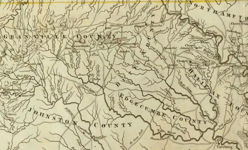
Below is a partial map of 1776 North Carolina showing the counties at that time.

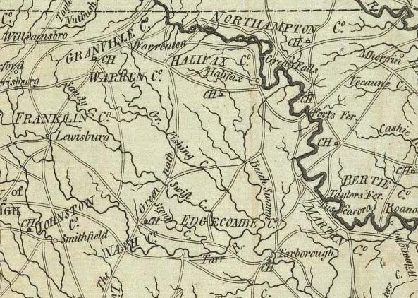
Below is a partial map of 1795 North Carolina showing the counties at that time.

Below are links to maps showing historical counties in North Carolina courtesy of Carolana.com.  It's an interesting web site that has a lot of historical information about the Carolinas.

Carolina.com Home Page

North and South Carolina Historical Maps

1729 Carolina Map

1729 North Carolina Counties

1740 Carolina Map

1750 North Carolina Counties

1760 Carolina Map

1770 North Carolina Counties

1775 Carolina Map

1777 Carolina Map

1780 North Carolina Counties

1790 Carolina Map

1800 North Carolina Counties

1810 Carolina Map